
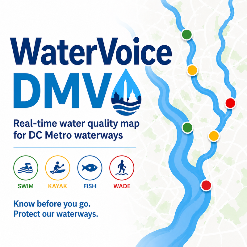
WaterVoice DMV
A real-time water quality map that tells DC Metro residents whether local waterways are safe to swim, kayak, fish, or wade.
Why This Matters
No unified tool tells residents whether their local waterways are safe to swim, kayak, or fish. Water quality data is scattered across federal agencies, county departments, and utilities, each with its own format, cadence, and reach. The result is that the people who actually use these waters have nowhere to look before they get in.
The Solution
An interactive map covering the Potomac, Anacostia, Four Mile Run, and Rock Creek that turns scattered data into a clear, activity-aware safety read.
- Safe / Caution / Unsafe by activity: swim, kayak, fish, and wade, since the right answer differs by how you use the water.
- Multi-source data: USGS, EPA, Arlington County, and Alexandria Renew, unified into one view.
- Post-storm alerts: flagging the runoff conditions that make waterways unsafe after rain.
- Water Quality Index (WQI) display: the underlying readings, not just a label.
- Mobile-ready: built for checking conditions at the water's edge.
Geography / Reach
Focused on the DC Metro region's waterways (the Potomac, Anacostia, Four Mile Run, and Rock Creek), serving residents across the DMV.
Our Story
WaterVoice DMV is led by Rajiv Sundar in partnership with the Four Mile Run Conservancy, bringing together civic technologists and local environmental stewards to build the tool DC residents deserve.
Community Partner
Come Join Us
Help build the map DC residents deserve. Everyone is welcome no matter your skill level or background. We especially need help with:
- GIS / Mapping
- Data Engineering
- React Frontend
- Environmental Analysis
- Project Management