
Open Election Map
A map to display the results of Washington DC's 2014 General Election in collaboration with NPR affiliate, WAMU.
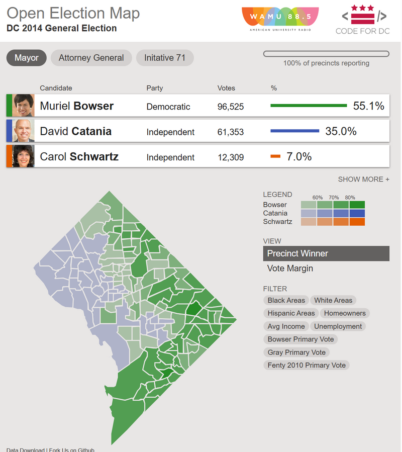
Open Election Map was an interactive election visualization map created in partnership with WAMU 88.5 for DC’s 2014 general election. The tool displayed precinct-level election results and allowed users to explore voting patterns alongside demographic filters such as race, income, unemployment, homeownership, and prior election results. It combines data from the DC Board of Elections and NeighborhoodInfo DC.
Explore the Open Election Map.